Monday, September 2, 2013

A sailing we go...sort of

Well, we actually had a day where we mostly drove and got some miles in. We left Munising and drove to St. Ignace, a cute little tourist trap right to the north of the bridge leading downstate. You can take an expensive ferry to even more expensive Mackinac Island but we decided to pass on that. We spent a restless night in the Comfort Inn parking lot, listening to late arrivals, car alarms, garbage trucks, early departures....They did have good WIFI. Thayer spent the morning working and I walked into the town and browsed around. There was a nice museum of the Chippewa and Ojibwe tribes with very informative exhibits about the importance of family, trade and migration, and canoe building. The fellow working there was a very nice young man, we had a heart to heart talk about life. I found out the white cedar is their "tree of life", much like the western red cedar in the NW.
P1100067
As I continued down the main street I was accosted by a bakery that reached out and dragged me in the door. I tried to resist but the salted pecan carmel topped cinnamon butter crispy rolls jumped into a bag and begged me to take them. They were only $.50 each! I only bought two. Then I only ate one and saved one for Thayer. It was a real battle! The sad part was that it was repeated a short time later when I had to wait for Thayer to come back and pick me up and I made the mistake of waiting in front of the bakery.  I resisted until the very end, and when he didn't come and didn't come, my resolve was shattered and I bought two more of the little butters. For tomorrow, I promise. Tell me if you could resist this little darling -->

Well, after that debacle we drove to the bridge overlook and read up on the history of the bridge and took some photos. Then we got to pay $10 to cross the mighty thing and we were officially downstate.  
P1100075The plan was to drive down the west side of the the peninsula, taking in whatever sights we happened upon. There are definitely more people and traffic in this part of the state!  We powered through a few biggish weekend resort towns and then, as we were tooling along Suttons Bay I spotted the tall masts of a schooner at the town docks.  Thayer drove us through a construction zone to get us there but we made it. We found the "Inland Seas" at the end of the dock, a 65+ ft steel hulled schooner. We talked with the young man aboard and found out that she is the floating classroom for the Inland Seas Education Association, a non-profit environmental education organization. Their mission is to expose mostly kids, but their families too, to science activities and investigations that teach them about the wonderful Great Lakes. We decided to spend the night here and then find out if we could get on the boat the next day. We found a great overnight spot near a local park. First thing in the morning we got to eat those delightful little butter bombs that I bought yesterday, chased down with some healthy fruit.

P1100089Then we made our way to the center and talked to the skipper of the boat. They were going on a cruise later that day but didn't need volunteers, however there was space available for paying customers. Since the cost was less than cruise to the Pictured Rocks that was refunded, we had no difficulty in deciding to go. We had enough time to visit a lighthouse down the road before the boat left(on a 3 hour cruise) so we quickly visited the Grand Traverse Lighthouse then came back to Suttons Bay. 
After a quick introduction and safety schpeel we got underway. There were about 30 passengers, 5 instructors and 4 crew on the boat.  First thing we did was motor out to about 60 ft of water and collect 4 different samples that would be used for the small group activities. We towed an Otter trawl to drag samples from near the bottom, we used a Ponar sediment grabber for the goop on the bottom, a plankton net, and a Van Dorn sampler to get water from the bottom. This part took too long because it was very hot and we were just sitting and watching while the kids got all the fun. Once this was accomplished we hoisted the sails and tried sailing in the light muggy air. I got to haul up the mail sail and must say that I did most of it with very little help from the 3 little girls who were supposed to be tailing for me.

P1100042NewImageThen we broke up into smaller groups and did 5 different stations to see the stuff we had hauled up and to identify and test the samples. We explored plankton, fish, sediments, and chemistry. I won't describe each activity but will try to explain what we learned.
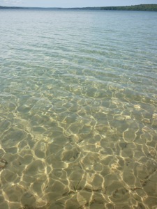
1. The plankton in the Great Lakes is declining due to exotic species of bivalves that have gotten into the lakes. They are very efficient filterers and reproducers. The water is beautifully clear. Unfortunately, this is bad for the native animals because they don't have as much food, they are getting crowded out.  
2. The population of invasives has increased hugely in the past 20 years- mainly zebra mussels and quagga (another bivalve).
P1100064
3. The diversity of fish has decreased as pressure from invasive species increases. Round gobies are taking over the lakes, though they think that native fish may be starting recognize them as something to eat and eat them.
4. Asian Carp are creeping up the Mississippi watershed toward the GL, only thing keeping them out are electric fences in the canals connecting the Mississippi watershed to the Lakes. The big worry is that the wetlands that connect the two watersheds will have catastrophic flooding that will allow the fish to pass from the Mississippi watershed to the GL watershed. These wetlands are less than 200 feet above the lake and river levels. These guys are bad news.

Some other interesting facts about the GL.
P1100079They contain 20% of Earth's fresh water! Other countries are interested in getting their hands on this water, including the Japanese. Not sure how they would transport it but...
The lakes have their own salmon runs, they spawn in the rivers and swim the lakes to grow up instead of an ocean. We saw some fishermen filleting some beautiful Kings today.
The funding for fighting invasives has been cut from about $480 mil to about $60 mil. 
We were surprised to not see much in the way of water skiers, sailing, jet skis, most boats were of the fishing variety. Maybe it is just because boats look so tiny in the vast waters.

Because this was a "3 Hour Tour" and no one wanted to chance getting stranded on some desert isle with Gilligan and Co., the skipper asked me to take over at the helm and steer us safely home. My sailing prowess was immediately recognized and we made it back to port without incident (except for some sore smilin' muscles).
P1100136
After our educational cruise we cut across to the western shore and found a nice camping place in Sleeping Bear National Lakeshore on Good Harbor. The mosquitos were swarming but we were safe in our little rig. The next morning I walked on the long empty beach. Little did I know that this was the place I should be looking for Petoskey stones which are fossilized coral. A guy showed me what they looked like but they would have been pretty tough to find. This is a picture of a nice polished one, the ones on the beach have to be wet to see the distinctive patterns. The family looking for stones did find some.
NewImage                                     
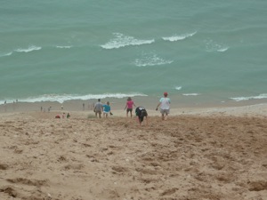
We went on the scenic drive in the park which included beautiful forests, dune areas and beaches. From the highest observation point you could bounce your way down the dune all the way to the shore in deep, soft, golden sand. It was very steep however and once you got all the way down there you had no choice but to crawl/climb all the way back up in the same soft, slippery sand. Lots of people were doing it and having a lovely time. I did a little bouncing and you can see that on facebook if you have a strong stomach. I felt like we could have spent more time at this park but we had a boondocking host lined up and had to get there. Jon and Gail turned out to be very entertaining and gave us some pointers for the next day. Nice quiet night out in the middle of farming country.
P1100150
P1100132

Friday, August 30, 2013

Pictured Rocks National Lakeshore


Our next stopping place was Munising, MI, jumping off place for the Pictured Rocks National Lakeshore. I just had to correct myself two times there and write Lakeshore instead of Seashore! These lakes are so large they look just like the ocean, ...hard to wrap my head around it all. The lighthouses don't make it any easier to remember. Anyway, I bought tickets for the sunset cruise (the most popular cruise because of the rosy glow of sunset) in eager anticipation of seeing the famous rocks from the water. I then made friends with a fellow selling fish sandwiches (Greg) down the way, found out what all to see before our cruise time, made a date for us to have dinner with him, and even got an invitation to park the rig for the night on a piece of his property down the road. You would be proud of how my friendship skills are developing!


While I rode my bike around Thayer did his programming stuff for Chris, finding good internet right near the boat dock. I pedaled a few miles down to a waterfall and a perfect little beach on the bay called, fittingly enough, Sand Point. The sand was just like the finest golden brown sugar, without the sticky. The beach sloped out gently for about 100 feet before dropping into the lovely, clear blue green depths. There were a few people there but not many, and I really felt the need for Jackson to help me enjoy it all and to play with. I splashed around to cool off as the day was again pretty warm and sticky. I rode back to town, explored around a bit, found the thrift store and grocery store and just coasted around looking at the old buildings. 
P1090964P1090966
Later that afternoon we walked down to the fish shack, visited with Greg while he made our whitefish sandwiches and homemade fries (we brought the beer), then enjoyed our meal. Overlooking the fact that we always forget something, we headed down to the dock for the cruise. We and our approximately 80 new shipmates cruised by Grand Island and the old lighthouse on our way to the main event. Unfortunately, dead ahead, loomed a gloomy fog bank, sitting there like a big old wool blanket ready to tuck us in for the night. We were able to see a few of the fabulous pictured rocks before getting engulfed in the wooly interior of the fog. 
As the temperature dropped we realized what we had forgotten, Thayer's jacket. Being the tough old salt that he is, he did not whine or complain one little bit. It wasn't freezing fog anyway. Well, the short story is that the boat ended up turning around early and we received a full refund for our trip. But, as you can see, I did get a few good pictures and I'll bet you can't tell which ones I ripped off from Google images or our friend Anna Berger's blog. The color of the water was incredible, even in the fog.


P1090989P1100003 


P1100001


 For those of you who don't know, Anna and Emir Berger are the wonderful Australians we met a few years ago who inspired this year long adventure. Anna is a fantastic photographer and wrote up an amazing blog about their year and a half journey around the US with their delightful and beautiful daughters, Jordan and Bella.
P1090979

P1100005 


Now comes the educational geology part of the post so you may opt to quit reading now. These sandstone formations range in age from 1.1 billion y.o. (the dark red ones at the bottom) to 400-500 million y.o. (gray on top.) They were formed in ancient seas, wetlands and rivers. The top gray layer is harder than the others and has helped form these beautiful cliffs by protecting the softer layers underneath from erosion. The vertical streaking of black, brown, white, green and red is caused by minerals in water that flow between the layers of rock and drip down the cliffs. The most common minerals are iron, manganese and copper. The caves and arches are caused from the tremendous wave action of the great lake. I find it remarkable that the layers are still parallel to the water after a billion years, this must be a relatively stable part of the North American continent.
Oh, and by the way, these are all my photos. I didn't need to steal any!
P1050686

Those crazy Aussies, the Bergers! Thanks for getting us inspired!


Tuesday, August 27, 2013

Keweenaw Peninsula

P1090828
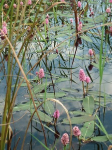
wetland flowers

We finished up PMWSP the next day, I went for a 5 mile hike through the woods while Thayer continued his computer work for his friend Chris.  He is setting up a website and working on product information and labeling.  It is an ongoing project that he seems to enjoy.  The woods were very beautiful, filled with maple, oak, cedar and many unfamiliar trees.  I imagined that this is what the eastern part of the US looked like when "A squirrel could go from the Atlantic to the Mississippi without touching the ground!"  I don't know who said that but I've heard it many times. It didn't take me long to do the hike, the bugs were very motivating!
P1090841
endless canopy of trees


P1090834
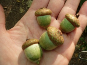
acorns from the mighty oaks


We then continued up the Keweenaw Peninsula, viewing the Eagle River Lighthouse and enjoying the lake views. Incredibly, we are just starting to see the fall colors coming out!  It appears that the sugar maples lead the way into fall, with their leaves just starting to turn on select branches. Just as it got dark we pulled into a cool wayside park on a little bay near Eagle Harbor.  It rained like crazy that night!


P1090855
Eagle River Lighthouse
P1090870
roadside pullout


The next day we drove just a little further up to the very top of Keweenaw to Fort Wilkens SP.  I am really beginning to appreciate the time, money and effort that has gone into the preservation of our historical treasures.  Here again is another beautifully preserved fort from the 1860's.  It was built to manage the rapidly growing trade and rowdy people that were coming to the area for copper, lumber, and mischief.  It wasn't used for very long, typical of boom and bust economies.  We toured the fort and bicycled around the park.
P1090875
blacksmith shop
P1090882
Ft. Wilkens SP
P1090884
general store


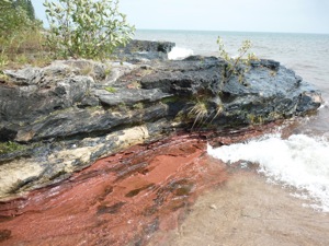
Now we headed back down the other side of the peninsula, the south side, taking in new sights and delights. We stopped at Brunette Beach and while Thayer dozed I walked up the beach to see the amazing rock formations. Sorry, here I go again! I'll try to be brief. This where all this sand is coming from!  Sedimentary rocks ranging in age from 1.5 Billion years to only 500 million years surround this lobe of Lake Superior. Needless to say glaciers, winter ice, monstrous winter waves, rivers and streams and wind have taken their toll on these soft layers of beautifully colored rocks. The lowest layers (1.5B), the Jacobville layers, are some of the oldest rocks you can see exposed in the US! They are the dark red rocks you see in the photos. Other subsequent layers are in gray, white and tan. We will visit these layers again when we go to Pictured Rock National Lakeshore.  But today I just moseyed along enjoying the interesting looping swirls of color along the shore. You will also see lots of lovely, rounded darker rocks that don't seem to fit in with all the others. These are glacial erratics transported here from the granite mountains of Canada. They come in all colors, textures, and sizes, most beautifully rounded and polished by the initial glacier transport and then by the pounding waves and swirling sand of the lake. There are also agates galore, their translucent colors just shine in the splash zone. I had to go back to the rig and convince Thayer to come have a look, boy, was he glad he did!

P1090898
Jacobville layer on the bottom 1.5 billion y.o.
P1090914
Canadian granite


P1090942
erratic amid the sandstone


Brunette Beach 8.2 miles north of Gay, MI

P1090950
agates

That night got a little tense as we drove into the darkness without a lot of turnouts for overnight. But Thayer rose to the occasion, found a forest service road,  and we settled in on a dead end. On the way in we had seen a large lightening storm brewing to the east. A few hours after we stopped it slowly rolled over us lighting up the sky with almost constant lightning for a good 45 minutes or so.  The lightning was high in the clouds so it wasn't too scary but it was simply an amazing light show! I've never seen anything like it! This was the hottest night yet, 90+ degrees, 90%humidity, with NO air movement, absolutely stifling!  One of the few hardships we must endure.


Monday, August 26, 2013

Prepare yourself for rock pictures...

I warned you, PMWSP has some pretty interesting rocks and geologic goings on!  It has the Nonsuch Shales near the bottom, metamorphosed sedimentary layers from vast old oceans in colors of black, gray, rust and pink. On top of the shales are the basalt layers laid down by a violent period of volcanic activity, all you northwesterners are familiar with that kind of action.  The massive weight of the basalt caused all kinds of tilting and sagging of the sedimentary and metamorphic layers. Then along came the glaciers to scrape and grind them down, pulverize them, and generally cause a lot of damage. At some point a LOT of lovely golden sand was created and used to decorate the shore of scenic Superior.

OK, with that possibly, sort of, accurate description, I'll tell you about our activities.  We spent one whole day walking up and down the Presque Isle River in the west corner of the park.  This small river spills down the watershed, carving its way over and through the Nonsuch Shales and patches of much softer sandstone.  The result is very beautiful and fun to explore.  


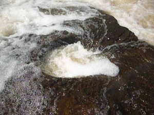
There are 3 or 4 larger falls where the river flows off of sharp edges of the shale. Most of the river is quite shallow as it spreads across the flat rocks.  The water itself is tinted brown and has a lot of foam, not because it is dirty, but because of organic matter in the soils that the water flows through.  The trails wind through the shady forest and there are frequent overlooks and places to go and wade around in the stream. This time of year it is warm and pleasant but I'm sure in the spring that river is a real rip snorter. They get a lot of snow here!  We found crawdads in the pools and some interesting invertebrate larvae that were attached, head down, to the rocks in the shallow riffles.  There were very circular holes drilled into the shale where rocks just ground the rock down during high water flow. 

As the river flowed into Superior it formed a nice big pool just daring Thayer to skinny dip in. It looked inviting but I declined to join him and was glad I didn't because, shortly after he got in, a herd of young boys and their dippy mom/aunt came down to skip rocks for half an hour. Wouldn't want to traumatize any youngsters! 

The shales in this area were really interesting because they were petrified sand ripples and were broken in such a way that you could see that each layer had a different color, direction of ripples and texture. I hope my pictures will illustrate that for you.  See if you can match the picture to something I described...

After such a vigorous day of hiking and exploring we fell asleep in our chairs and read books on the beach until the sun did another glorious dive into the lake.  Found an empty trailer parking lot near a trailhead to spend the night.  We were the only ones there besides the owls that kept me awake for a while.
P1090722P1090755P1090748P1090767P1090779P1090778P1090733
P1090811P1090661P1090789x

Wednesday, August 21, 2013

Ashland and Boondocking and beyond


P1090643
Ice Cream at Buddies!
We stopped in Ashland, WI for a bike ride around the waterfront and town.  I love the riding, everything we've done is reasonably flat, we ride as long or short as we want, we see historic towns, lake views, and places we don't see from the rig.  The BEST part about this stop was BUDDIES, a little eatery on Main St.  A small cone ($2.50) consisted of more than a pint of good ice cream packed firmly down in a full size waffle cone. We each had one about 4:00 and really didn't need dinner.  One of those spectacular finds!

P1090652
Boondocking at Barb and Don's
A few months ago I had signed up with an organization called Boondocking.  For $30/year you get online access to 1000's of RVers who offer up a parking space on their property for free!  All you do is contact them via email a few days (or more) ahead of when you will be arriving.  If it is convenient for them, they give you the address and off you go!  We did our first boondocking in Park Falls, WI on Aug. 22.  I talked to Barb on the  phone, we drove there, backed into her driveway, plugged into their power and WIFI, chatted and went to bed.  They left early the next morning so we slept in, Thayer did some more work(!), and I rode my bike around town and did some thrift store shopping.  I have contacted a few other possible boondockers down the road, it is nice to have a place to stay and it's a fun way to meet people.  It's also a good way to get that valuable local knowledge. There are boondocker opportunities in every state (except ND, SD) and quite a few in Canada. 
P1090668
Lake of the Clouds- Porcupine Mtn. Wilderness SP
 After checking the tires and plumping them up, we actually did some driving and drove to Porcupine Mountains Wilderness State Park, located at the base of the Keweenaw Peninsula on Lake Superior.  We got there in the nick of time to check into the visitor center to buy an annual State Park Pass for Michigan.  Then we drove up   to the "Lake of the Clouds" overlook on the lake side of the park.  PMWSP is the largest state park in Michigan, it almost grew up to be a National Park.  It has a very interesting geology and I'll make you look at some rock pictures to prove it in my next post.  As evening came, we watched the sun set in a flaming puddle of light in the lake.  We found a nice pullout on the boundary road for the night, dang moon was so bright I had to wear my eyeshades.
sunset over Superior
happy campers