Monday, September 9, 2013

Cleveland-Akron-Cuyahoga

P1100259Last night as we were approaching our next stop we rounded a bend and were astonished by a fabulous sight. A two story, colonial building, housing a restaurant, was ablaze with light, streaming from countless magnificent chandeliers on each floor. Agog, we imagined our grubby selves seated and eating in such a fine establishment. We stealthily cased the neighborhood, finding a quiet parking lot nearby for the night, vowing that we were going to eat breakfast there, cost be damned! We are on vacation! Chances like this don't come around every day!

Bright and early this morning we cleaned ourselves as best we could and marched right in. We were courteously greeted at the counter by a cheerful teenager with a pierced nostril. Thayer ordered the most expensive breakfast on the menu, the Breakfast Platter, and I chose a sausage egg McMuffin and a cup of coffee. We smugly enjoyed our lovely breakfast under a softly glowing chandelier at the most elegant McDonald's in America. Living large in Ohio.

But seriously now...
Right smack in the middle of the Cleveland-Akron corridor sits a lovely gem of a park. It is a conglomeration of federal, state, county and regional parks hop-scotched together into a patchwork park they call Cuyahoga Valley National Park. Created recently (2000), the goal was to bring recreational opportunities to many people and to preserve this beautiful, historic and environmentally important area surrounding the Cuyhoga River. The waterway was an easy pathway for Native Americans to migrate from their northern summer hunting and foraging grounds to their warmer winter homes to the south. It was used by so many different tribes that there was an agreement among them that they could not engage in hostilities while traveling through the area. Early trappers and traders recognized its value for moving goods from east to midwest and vice versa.

P1100274P1100291P1100279Today we explored one side of the park, walked to some falls on a creek that must be spectacular when there is water flowing over the rocks. As it was? eh. Interesting rock formations though. The Brecksville Nature Center was a lovely little lodge in the woods, built in the 30's by WPA workers, made of rock and wormy walnut from the surrounding area. It had many nice carved details, birds, squirrels and leaves to adorn the walls and joinery. The handmade rocking chairs were very beautiful and comfortable and I took many photos so that Thayer can make us some when we get home. He fell asleep in one of them and started snoring, blending in nicely with the sounds of the forest.  
P1100286
There were many trails to choose from, forest, meadows of flowers, streams, and grassland. I attempted to identify some of the many, many unfamiliar trees in the forests here.

I fell in love with blue stem prairie grass today. So I am not only a knee-jerk liberal tree hugger and rock hugger, but a grass hugger to boot! I asked for some more information on the trees after our hike and can now identify red and white oak, red maple, beech and the tulip tree. Not much of a start on these diverse forests, but something nonetheless.

The inside word about that McD's:  the only way the snooty, rich folks living here 20 years ago would let McD's come to their town was if they built a nice looking restaurant. That tidbit of information is thanks to Gary, the RC airplane enthusiast we visited with tonight. We had a nice quiet night in the corner of a picnic area, just the insects and early morning birds to listen to.
The very next day.....
P1100305
We drove to the Brecksville Station near the north end of the park, our plan being to ride the 12 miles to the south end on our bikes, and then enjoy a lovely train ride back to the rig. The Towpath parallels the canal that lifted barges almost 400 ft. through a series of locks from Lake Erie to the Ohio River near Akron, OH. The canal was dug in 2 years (1825-7) by HAND by German and Irish immigrants. It stretched 308 miles and contained 44 locks that did the heavy lifting. It was 4 feet deep and about 40 wide, though the locks were narrower, accommodating only one 17 X 60-80 ft. barge. We learned that most of it was not filled with river water but the water came from the tributaries of the Cuyahoga River.

The Cuyahoga River Valley and the Ohio & Erie Canal have a rich history of trade, transportation, farming and industry. This canal, along with the Erie Canal, united vast areas of our country to transport the incredible natural resources and grain of the west and midwest to the east. After the railway came through, the canal became obsolete and in 1913 was made unusable by a big flood.
P1100313

Today, the old canal itself is a mixture of lovely meadows, wetlands and forests. It winds along the Cuyahoga River and even crosses over it at one point. The towpath was crushed, compacted gravel and stretches of pavement that was very easy to ride on our road bikes. There are many interpretive signs along the way detailing the history and features of the canal, river, towpath and environment. Midway, we stopped at a visitors center and enjoyed talking with a ranger and learning more about the area and it's history. We also were informed that the train doesn't run on Mondays and Tuesdays so we would be biking both ways. Not a problem, though I was dreadfully disappointed not to get a train ride! We made sure that we knew where to buy ice cream on our way back and continued down the path, cruising a few of the little towns and farms left over from the canal heydays.

P1100321P1100326We also stumbled across the best gas prices we have seen since departing from the NW. Sadly, we had only just filled our fuel tank and didn't need any more. Also, the station was closed (and had been for about 50 years).
P1100324
P1100343We stopped at the Beaver Marsh near the south end of the park to admire the transformation that a few determined beavers can accomplish in just a few years. 20 years ago there was an unsightly auto wrecking yard near the river that was slated to become a parking lot by the park to accommodate visitors to a planned venue of some sort. They cleared the wreckage out of the area near the river and shortly thereafter a few beaver ventured back into the park after being gone for over a hundred years. They built a nice dam, the park tore it down, the beaver built it again, the park tore it down. The third time the park decided to let the beaver stay and they have been excellent stewards of the area every since. There are now about 8 lodges surrounding a large pond and wetland just filled with plant and animal life. We saw birds, large and small fish, frogs, turtles and vast lily pad areas, sometimes moving randomly and vigorously with unseen creatures. This was our turnaround point and, as it was getting quite hot and muggy, we pedaled eagerly back toward the ice cream store (FYI, we indulged on locally made salted caramel).
P1100353
It was one of those days that gave my smiling muscles a great workout. At first Thayer was riding behind me but I was driving him crazy (or off the trail) by my constant swerving and slowing to look at things and rubbernecking at the lovely and spectacular views. Needless to say he got to go first for a while after that.

I enjoyed the history and natural beauty of this lovely park. I continue to be astonished and amazed at the wonderful parks that we have in our country. This one was a special one, tucked in between two large cities, administered by collection of agencies, all with the same goal of preserving our natural and historical treasures. It was the dream child of several Ohio politicians who worked tirelessly over many years to make it a reality. It certainly deserves its nickname: The Emerald Necklace.
P1100367
P1100350

Saturday, September 7, 2013

Marblehead

Marblehead, Ohio, sits on the southern edge of Lake Erie with its lighthouse a beacon into the dark for the many ships navigating the treacherous waters of the lake. With modern navigation equipment all of the beautiful lighthouses are really not needed but fortunately they are maintained and kept open for the enjoyment of all, and for those poor slobs who don't have cool navigation equipment. I think Thayer might be getting tired of me wanting to visit lighthouses but too bad. I like em. They tend to get me near the water which is what I need on a hot day. Marblehead is also where a small ferry takes people out to Kelley Island, about a 20 minute ride. I opted to go to the island while Thayer stayed in Marblehead. I took my bike and had a great time cycling around the 4 x 2 mile island. It was just the right size for me to see everything, riding or walking. The roads were mostly paved and traffic was about 2/3 bike and golf cart and 1/3 car traffic. It also turned out to be "Treasure Island" weekend when all the locals have a yard sale! I stopped at about 3 or 4 and was not tempted by a single item. The stuff was so junky I just started riding by. There was too much other good stuff to see!
P1100206P1100213

I slowly cruised the tiny town but didn't stop, I was on my way to see some rocks! Kelley Is. just happens to be the world's BEST place to see the effects of glacial scouring on soft limestone rock. The trenches in this area are 8-10 ft deep, 35-40 feet across and run for about 300 ft. Many more of the marks existed, many of them much more impressive than these, but, alas, they were destroyed during the quarrying of limestone for building blocks. Feast your eyes on these glacial grooves! Yes, I know, I get more excited about this stuff than most of you...you must admit they are impressive.
P1100216P1100219


P1100227
3-400 years ago the Natives that lived here recorded important events on a large limestone slab, now called the "Inscription Rock." It sits under a shelter now because it is so eroded from weather that you can't really see the marks. Fortunately, a visiting military man made a detailed drawing of it back in the 1870's so we have a record of what it once looked like.
P1100208
P1100209


There were other interesting things to see on the island, some pretty beaches, spooky ruins in the forest(remnants of the quarry), and rare ecosystems of freshwater lakes and limestone shores. I took a short walk on a fancy boardwalk around one of only 3 (yes, three) remaining wetlands on this huge Lake Erie. This area was obviously "developed" way before the value of wetlands was recognized. The old story of not knowing what we are losing when we destroy the natural systems that make our planet healthy. I think of the many places we've seen where they are now trying to get wetlands re-established, recognizing the many benefits they provide to animals, plants and communities. 
P1100231
P1100242
P1100234


The island was historically interesting as well, before Prohibition there were 25 wineries on the island. They had a lot of agriculture to provide most of their own food, as well as the quarry providing jobs. In the winter they would cut blocks of ice out of the lake and store them in straw, in a barn, for summertime ice for ice boxes. There are many beautiful old homes on the water, many made out of the native stone.
P1100245
P1100212
P1100244

After I returned from the island Thayer and I biked down to the Marblehead Lighthouse for photos. We had to dodge around the 2 weddings that were occurring while we were there. 
P1100251P1100256

Friday, September 6, 2013

Bits and Pieces

P1100164
Its been a while since I posted so I've had to look back through my notebook to recall the past 8 or 9 days. How do they go by so fast?


After Sleeping Bear we drove to a little town called Pentwater where we were early enough to grab a good parking spot at Charles Mear SP which is very near the town. It has a nice beach and a huge campground simply PACKED with people, it being Labor Day Weekend. We didn't spend much time at the park but unloaded the bikes and cruised the town. We found some Ensign class sailors waiting for wind at the local yacht club and chatted with them about the town, its history, and sailing, of course. It is more fun to learn about a place from some locals than visiting a museum or visitor center we've decided. We tried to get a little ride on a boat but they didn't seem to want our valuable opinions about all things sailing. In town we saw some fishermen cleaning and filleting some big King salmon at the boat ramp. Turns out that they are just like our salmon except they don't grow to adulthood in the ocean, they grow up in the Great Lakes and spawn in the rivers that flow into the lakes. I had no idea that there were Great Lake Salmon! The next discovery was an estate auction going on in a nearby neighborhood. It was a good thing we are traveling in a little RV and we were on bikes. There were a few nice things that I don't need but they wouldn't get to the auction block until much later in the day. whew! Later that day we drove further down the coast to Silver Lake SP which was also busy. Another fantastic beach, this one with a pretty lighthouse and sand dunes.
P1100174P1100172P1100182
We spent that night with some Boondocking folks who had a very interesting RV history. They spent 12 years work/camping. This entails traveling to a place that you would like to spend some time and working there for 8-10 weeks at whatever kind of job you could find. Several years of this time they worked for a company doing hearing testing around the country. OSHA requires businesses with loud workplaces to test the hearing of their employees every so often. The business hires this company to send a crew to test their employees. They also worked in national parks at hotels, restaurants, maintenance, retail, campground hosting.... 

P1100187
P1100190They were very nice folks and very encouraging to us newbies. They sent us to Fankenmuth, Michigan for our Bavarian Experience, think Leavenworth X10. Most of it was just tourist stuff but a restaurant named Zenghers was highly recommended to us and we soon tested their reputation for ourselves. We were fed to the gills with their all-you-can-eat chicken dinner, which is what we also now recommend if you should visit the area. We started with chicken noodle soup, two kinds of bread, pate' and toast, cheese, coleslaw, cranberry relish and cottage cheese. Then the main course arrived, consisting of nicely baked, crispy chicken, dressing, mashed potatoes, green beans, gravy and buttered noodles. If a bowl went empty it could be refilled in a heartbeat and we had more of the cranberry relish, potatoes and green beans. Fortunately dessert was just ice cream because I don't think I could have handled anything more. We rolled out of there like butterball turkeys and waddled around the tourist shops until we could hoist ourselves onto our bikes again. The other "must see" experience in Frankenmuth is the Bronner's Christmas Wonderland with acres of Christmas stuff, elves, Santas and carols playing on the speakers. You can have this experience 361 days a year! We lasted only about 15 minutes which was how much time it took to walk around about a quarter of the store. It was extremely over the top!


P1100193P1100196P1100197Then we hit the road for Ann Arbor and my cousin Lynnae's home. Lynnae is 9 years younger than me and we have never spent much time together so it was a nice chance to rectify that situation. It was a busy five days, she and her two wonderful kids, Calvin (age 8) and Vivian (age 5) were just starting the new school year (and I'M NOT!!!), adjusting to a different routine and juggling a lot of activities. Lynnae teaches theatre at a college on the other side of town and then some. I tried to help, without being too much in the way, with some cooking, cleaning, getting Lynnae out for a break or two, giving lots of advice(who can resist with a younger cousin?) and hanging out with the kids some. Thayer worked on the rig, managing some repairs and maintenance, and played some checkers with the kids (hello? who's making up the rules??) I went on a couple of bike rides, one day to a little town called Dexter where they have a darn good bakery that makes a fine apple critter. I know, just what I needed after that chicken dinner, right? The days flew by and we really enjoyed spending time with her and the kids. But, not to overstay our welcome, it was soon time to move on.


And as the sun set that evening we tucked ourselves away in a little town called Marblehead, OH.

Monday, September 2, 2013

A sailing we go...sort of

Well, we actually had a day where we mostly drove and got some miles in. We left Munising and drove to St. Ignace, a cute little tourist trap right to the north of the bridge leading downstate. You can take an expensive ferry to even more expensive Mackinac Island but we decided to pass on that. We spent a restless night in the Comfort Inn parking lot, listening to late arrivals, car alarms, garbage trucks, early departures....They did have good WIFI. Thayer spent the morning working and I walked into the town and browsed around. There was a nice museum of the Chippewa and Ojibwe tribes with very informative exhibits about the importance of family, trade and migration, and canoe building. The fellow working there was a very nice young man, we had a heart to heart talk about life. I found out the white cedar is their "tree of life", much like the western red cedar in the NW.
P1100067
As I continued down the main street I was accosted by a bakery that reached out and dragged me in the door. I tried to resist but the salted pecan carmel topped cinnamon butter crispy rolls jumped into a bag and begged me to take them. They were only $.50 each! I only bought two. Then I only ate one and saved one for Thayer. It was a real battle! The sad part was that it was repeated a short time later when I had to wait for Thayer to come back and pick me up and I made the mistake of waiting in front of the bakery.  I resisted until the very end, and when he didn't come and didn't come, my resolve was shattered and I bought two more of the little butters. For tomorrow, I promise. Tell me if you could resist this little darling -->

Well, after that debacle we drove to the bridge overlook and read up on the history of the bridge and took some photos. Then we got to pay $10 to cross the mighty thing and we were officially downstate.  
P1100075The plan was to drive down the west side of the the peninsula, taking in whatever sights we happened upon. There are definitely more people and traffic in this part of the state!  We powered through a few biggish weekend resort towns and then, as we were tooling along Suttons Bay I spotted the tall masts of a schooner at the town docks.  Thayer drove us through a construction zone to get us there but we made it. We found the "Inland Seas" at the end of the dock, a 65+ ft steel hulled schooner. We talked with the young man aboard and found out that she is the floating classroom for the Inland Seas Education Association, a non-profit environmental education organization. Their mission is to expose mostly kids, but their families too, to science activities and investigations that teach them about the wonderful Great Lakes. We decided to spend the night here and then find out if we could get on the boat the next day. We found a great overnight spot near a local park. First thing in the morning we got to eat those delightful little butter bombs that I bought yesterday, chased down with some healthy fruit.

P1100089Then we made our way to the center and talked to the skipper of the boat. They were going on a cruise later that day but didn't need volunteers, however there was space available for paying customers. Since the cost was less than cruise to the Pictured Rocks that was refunded, we had no difficulty in deciding to go. We had enough time to visit a lighthouse down the road before the boat left(on a 3 hour cruise) so we quickly visited the Grand Traverse Lighthouse then came back to Suttons Bay. 
After a quick introduction and safety schpeel we got underway. There were about 30 passengers, 5 instructors and 4 crew on the boat.  First thing we did was motor out to about 60 ft of water and collect 4 different samples that would be used for the small group activities. We towed an Otter trawl to drag samples from near the bottom, we used a Ponar sediment grabber for the goop on the bottom, a plankton net, and a Van Dorn sampler to get water from the bottom. This part took too long because it was very hot and we were just sitting and watching while the kids got all the fun. Once this was accomplished we hoisted the sails and tried sailing in the light muggy air. I got to haul up the mail sail and must say that I did most of it with very little help from the 3 little girls who were supposed to be tailing for me.

P1100042NewImageThen we broke up into smaller groups and did 5 different stations to see the stuff we had hauled up and to identify and test the samples. We explored plankton, fish, sediments, and chemistry. I won't describe each activity but will try to explain what we learned.
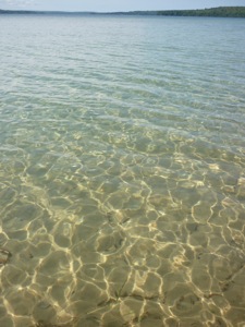
1. The plankton in the Great Lakes is declining due to exotic species of bivalves that have gotten into the lakes. They are very efficient filterers and reproducers. The water is beautifully clear. Unfortunately, this is bad for the native animals because they don't have as much food, they are getting crowded out.  
2. The population of invasives has increased hugely in the past 20 years- mainly zebra mussels and quagga (another bivalve).
P1100064
3. The diversity of fish has decreased as pressure from invasive species increases. Round gobies are taking over the lakes, though they think that native fish may be starting recognize them as something to eat and eat them.
4. Asian Carp are creeping up the Mississippi watershed toward the GL, only thing keeping them out are electric fences in the canals connecting the Mississippi watershed to the Lakes. The big worry is that the wetlands that connect the two watersheds will have catastrophic flooding that will allow the fish to pass from the Mississippi watershed to the GL watershed. These wetlands are less than 200 feet above the lake and river levels. These guys are bad news.

Some other interesting facts about the GL.
P1100079They contain 20% of Earth's fresh water! Other countries are interested in getting their hands on this water, including the Japanese. Not sure how they would transport it but...
The lakes have their own salmon runs, they spawn in the rivers and swim the lakes to grow up instead of an ocean. We saw some fishermen filleting some beautiful Kings today.
The funding for fighting invasives has been cut from about $480 mil to about $60 mil. 
We were surprised to not see much in the way of water skiers, sailing, jet skis, most boats were of the fishing variety. Maybe it is just because boats look so tiny in the vast waters.

Because this was a "3 Hour Tour" and no one wanted to chance getting stranded on some desert isle with Gilligan and Co., the skipper asked me to take over at the helm and steer us safely home. My sailing prowess was immediately recognized and we made it back to port without incident (except for some sore smilin' muscles).
P1100136
After our educational cruise we cut across to the western shore and found a nice camping place in Sleeping Bear National Lakeshore on Good Harbor. The mosquitos were swarming but we were safe in our little rig. The next morning I walked on the long empty beach. Little did I know that this was the place I should be looking for Petoskey stones which are fossilized coral. A guy showed me what they looked like but they would have been pretty tough to find. This is a picture of a nice polished one, the ones on the beach have to be wet to see the distinctive patterns. The family looking for stones did find some.
NewImage                                     
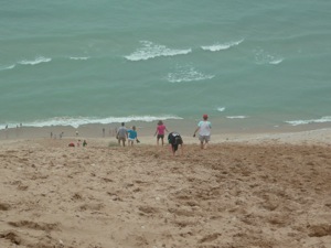
We went on the scenic drive in the park which included beautiful forests, dune areas and beaches. From the highest observation point you could bounce your way down the dune all the way to the shore in deep, soft, golden sand. It was very steep however and once you got all the way down there you had no choice but to crawl/climb all the way back up in the same soft, slippery sand. Lots of people were doing it and having a lovely time. I did a little bouncing and you can see that on facebook if you have a strong stomach. I felt like we could have spent more time at this park but we had a boondocking host lined up and had to get there. Jon and Gail turned out to be very entertaining and gave us some pointers for the next day. Nice quiet night out in the middle of farming country.
P1100150
P1100132

Friday, August 30, 2013

Pictured Rocks National Lakeshore


Our next stopping place was Munising, MI, jumping off place for the Pictured Rocks National Lakeshore. I just had to correct myself two times there and write Lakeshore instead of Seashore! These lakes are so large they look just like the ocean, ...hard to wrap my head around it all. The lighthouses don't make it any easier to remember. Anyway, I bought tickets for the sunset cruise (the most popular cruise because of the rosy glow of sunset) in eager anticipation of seeing the famous rocks from the water. I then made friends with a fellow selling fish sandwiches (Greg) down the way, found out what all to see before our cruise time, made a date for us to have dinner with him, and even got an invitation to park the rig for the night on a piece of his property down the road. You would be proud of how my friendship skills are developing!


While I rode my bike around Thayer did his programming stuff for Chris, finding good internet right near the boat dock. I pedaled a few miles down to a waterfall and a perfect little beach on the bay called, fittingly enough, Sand Point. The sand was just like the finest golden brown sugar, without the sticky. The beach sloped out gently for about 100 feet before dropping into the lovely, clear blue green depths. There were a few people there but not many, and I really felt the need for Jackson to help me enjoy it all and to play with. I splashed around to cool off as the day was again pretty warm and sticky. I rode back to town, explored around a bit, found the thrift store and grocery store and just coasted around looking at the old buildings. 
P1090964P1090966
Later that afternoon we walked down to the fish shack, visited with Greg while he made our whitefish sandwiches and homemade fries (we brought the beer), then enjoyed our meal. Overlooking the fact that we always forget something, we headed down to the dock for the cruise. We and our approximately 80 new shipmates cruised by Grand Island and the old lighthouse on our way to the main event. Unfortunately, dead ahead, loomed a gloomy fog bank, sitting there like a big old wool blanket ready to tuck us in for the night. We were able to see a few of the fabulous pictured rocks before getting engulfed in the wooly interior of the fog. 
As the temperature dropped we realized what we had forgotten, Thayer's jacket. Being the tough old salt that he is, he did not whine or complain one little bit. It wasn't freezing fog anyway. Well, the short story is that the boat ended up turning around early and we received a full refund for our trip. But, as you can see, I did get a few good pictures and I'll bet you can't tell which ones I ripped off from Google images or our friend Anna Berger's blog. The color of the water was incredible, even in the fog.


P1090989P1100003 


P1100001


 For those of you who don't know, Anna and Emir Berger are the wonderful Australians we met a few years ago who inspired this year long adventure. Anna is a fantastic photographer and wrote up an amazing blog about their year and a half journey around the US with their delightful and beautiful daughters, Jordan and Bella.
P1090979

P1100005 


Now comes the educational geology part of the post so you may opt to quit reading now. These sandstone formations range in age from 1.1 billion y.o. (the dark red ones at the bottom) to 400-500 million y.o. (gray on top.) They were formed in ancient seas, wetlands and rivers. The top gray layer is harder than the others and has helped form these beautiful cliffs by protecting the softer layers underneath from erosion. The vertical streaking of black, brown, white, green and red is caused by minerals in water that flow between the layers of rock and drip down the cliffs. The most common minerals are iron, manganese and copper. The caves and arches are caused from the tremendous wave action of the great lake. I find it remarkable that the layers are still parallel to the water after a billion years, this must be a relatively stable part of the North American continent.
Oh, and by the way, these are all my photos. I didn't need to steal any!
P1050686

Those crazy Aussies, the Bergers! Thanks for getting us inspired!